Spatial Scanning – Sometimes You Need Data Fast
Spatial Scanning – Sometimes You Need Data Fast

Design and construction always happen within the constraints of time. Sometimes you have plenty of time for a given task or milestone, but more often than not… well…. time is simply a luxury you can’t obtain. In these instances, BuildingPoint Spatial Scanning offers a clear and concise advantage, especially when it comes to acquiring and processing large and intricate data sets in a short (or previously thought to be impossible) period of time. With Spatial Scanning, BuildingPoint can build a scanning and delivery schedule that meets your timetable, rather than the other way around. This flexible capability means that you get the data you need, when you need it.
Minimal Acquisition Time
 Point cloud acquisition has traditionally been a rather time-consuming activity. With traditional static scanning, stations must be meticulously mapped out and planned in order to ensure complete coverage within an interior space. In addition to this detailed planning process, traditional point cloud acquisition methods require significant time on site to complete the scanning process. For projects struggling with either a compressed timeline, or limited access (or both) static scanning can be too little too late. With Spatial Scanning, pre-mission and point cloud acquisition are combined into a simple and efficient process. And because BuildingPoint leverages the best capabilities of both static and dynamic scanning workflows, point clouds of several hundred thousand square feet can be acquired in a single day. This minimizes the on-site presence and ensures a more rapid point cloud delivery schedule.
Lightning Quick Post-Processing
 Within traditional point cloud workflows, post-processing represents a huge portion of the data preparation process. Multiple scans must be registered and stitched together to form a cohesive and complete project point cloud. With BuildingPoint Spatial Scanning, post-processing is reduced to an automated batch process, meaning that size, scope, and intricacy are minimized, resulting in a completely predictable and efficient post-processing deliverable. As a result, not only will you know exactly when your fully registered point cloud will be delivered, but that point cloud will be delivered in days rather than weeks or longer when compared to traditional registration methods.
In a perfect world, projects can easily be managed to leverage technology and make the entire process more seamless, and more efficient. BuildingPoint Spatial Scanning is built for the all-too-real-world of construction and design. A world where deliverables are created quickly, accurately, and cost-effectively. To learn more about Spatial Scanning, or to discuss the real-world benefits you can experience on your next project, head over to buildingpointflorida.com/scanning


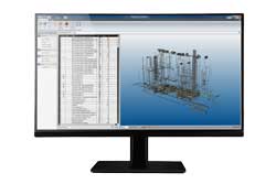 Building upon the immense power and success of Trimble Vico Office, the entirely new R6 represents a significant step forward for users looking to create leverage VDC practices in their construction and design processes. Whether it's model and document management, model takeoffs, or location breakdowns, Vico Office R6 can propel your model-based workflow to an entirely new level.
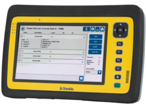 Trimble has just released the first enhancement to the all-new Trimble Field Link v4.0. Along with enhanced and improved reliability and performance, v4.01 also adds a number of user-requested features and capabilities. Some of these enhancements include:
You must be logged in to post a comment.